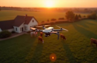
You may think that drone surveying is just a novelty, but it's a game-changer for industries that rely on accurate data and mapping. By harnessing the power of drones equipped with specialized sensors and cameras, you can capture precise data and images of an area with unprecedented speed and accuracy. But what makes drone surveying so effective, and how does it compare to traditional methods? To understand the full potential of this technology, crucial to break down its components and applications – starting with the basics of how drone surveying works.
Contents
Key Takeaways
- Drone surveying involves sensor calibration, flight planning, and data collection to create detailed 3D models and topographic maps.
- The technology offers benefits like cost savings, increased accuracy, enhanced safety, and improved data management.
- Types of drone surveying include aerial mapping, aerial LiDAR, drone payloads, and thermal sensors, each serving specific purposes.
- Drone surveying has various applications, including infrastructure development, environmental monitoring, mining, agriculture, and disaster response.
- The future of drone surveying will be shaped by advancements in technology, regulatory hurdles, and industry standards for data quality.
How Drone Surveying Works
When it comes to surveying a site, you're no longer limited to traditional methods on the ground.
Drone surveying offers a more efficient and accurate way to collect data. To guarantee accurate results, you need to calibrate the drone's sensors before the flight.
Sensor calibration involves adjusting the camera and GPS systems to verify they're working in sync and providing precise data.
Once the sensors are calibrated, you can start planning the flight.
Flight planning involves determining the ideal flight path, altitude, and speed to capture the required data.
You'll need to ponder factors such as weather conditions, air traffic, and site topography.
You can use specialized software to create a flight plan that verifies complete coverage of the site.
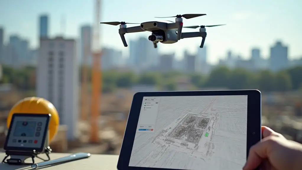
With the flight plan in place, you can launch the drone and start collecting data.
The drone will capture high-resolution images and GPS data, which can be used to create detailed 3D models and topographic maps.
Benefits of Drone Technology
Frequently, surveyors and site managers have turned to drone technology for its numerous benefits.
As you consider implementing drones in your surveying operations, crucially, you must understand the advantages they offer.
One of the primary benefits of drone technology is the cost savings it provides.
By reducing the need for manned aircraft and ground-based surveying crews, drones can substantially cut down on operational expenses.
Additionally, drones offer increased accuracy and efficiency in surveying operations.
- Cost savings: Reduced operational expenses due to lower equipment and labor costs
- Increased accuracy: High-resolution images and precise data collection capabilities
- Enhanced safety: Reduced risk of accidents and injuries for surveying personnel
- Improved data management: Streamlined data collection, processing, and analysis
- Increased productivity: Faster data collection and processing times, enabling quicker decision-making
Types of Drone Surveying
Now that you've considered the advantages of drone technology in surveying operations, it's time to look at the various types of drone surveying methods.
These methods are primarily classified based on the type of data being collected and the drone payloads used.
Aerial Mapping is one of the most common types of drone surveying, which involves creating detailed maps of an area by capturing high-resolution images and using photogrammetry software to process the data.
Another type of drone surveying is Aerial LiDAR (Light Detection and Ranging), which uses laser pulses to create high-accuracy 3D models of an area.
This method is particularly useful for collecting data in areas with dense vegetation or complex terrain.
Drone payloads also play a vital role in determining the type of drone surveying method used.
For instance, drones equipped with multispectral or hyperspectral sensors are used for crop monitoring and environmental monitoring, while drones with thermal sensors are used for detecting heat signatures.
Each type of drone surveying method has its unique advantages and applications, and selecting the right method depends on the specific surveying requirements.
Applications and Use Cases
Considering the unique capabilities of each drone surveying method, you can apply this technology to a wide range of industries and applications.
From infrastructure development to environmental conservation, drone surveying offers a cost-effective and efficient way to collect data.
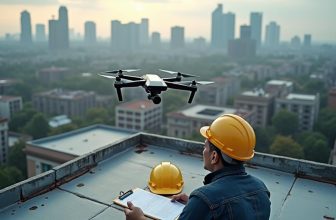
Aerial inspections, for instance, can be used to evaluate the condition of bridges, roads, and buildings, allowing for timely maintenance and repair.
Drone surveying has numerous use cases across various sectors.
Some of the key applications include:
- Infrastructure development: monitoring construction progress, inspecting infrastructure, and creating 3D models of buildings and bridges
- Environmental monitoring: tracking changes in land use, monitoring water quality, and detecting signs of natural disasters
- Mining and quarrying: monitoring excavation progress, tracking stockpile volumes, and detecting potential hazards
- Agriculture: monitoring crop health, detecting pests and diseases, and optimizing irrigation systems
- Disaster response: evaluating damage, identifying areas of need, and facilitating rescue operations
Future of Drone Surveying
As the technology advances and regulations evolve, you can expect drone surveying to become even more integrated into various industries, transforming the way data is collected, analyzed, and utilized.
You'll likely see significant improvements in drone design, sensor capabilities, and data processing algorithms, enabling more accurate and efficient surveys.
The adoption of drone surveying will also be influenced by regulatory hurdles, such as those related to airspace access, data security, and operator certification.
As these regulatory challenges are addressed, you can expect to see the development of industry standards for drone surveying, including guidelines for data quality, accuracy, and interoperability.
These standards will help guarantee that drone surveying becomes a reliable and trustworthy tool for industries such as construction, mining, and environmental monitoring.
You'll be able to rely on drone surveying for precise data, reduced survey times, and improved decision-making.
With ongoing advancements in technology and regulation, drone surveying is poised to revolutionize the way you collect, analyze, and utilize data in your industry.
Frequently Asked Questions
What Happens to Drone Survey Data After Collection?
After collecting drone data, you'll upload it to specialized software for processing, where you'll apply filters and corrections. Then, you'll integrate the data into a cloud-based system, enabling seamless storage and collaboration.
Are Drone Surveyors Required to Have a Pilot's License?
You'll need to comply with Drone Regulations, which vary by country, but typically require a remote pilot certification or license. Additionally, many drone surveyors also carry Drone Insurance to mitigate risks and protect themselves and clients financially.
Can Drones Survey in Extreme Weather Conditions?
You're likely wondering if drones can survey in extreme weather conditions. Consider a hypothetical scenario: a hurricane-stricken area. Drones can operate in strong winds, but weather limitations and reduced storm tolerance restrict their effectiveness and safety.
How Accurate Is GPS in Drone Surveying Technology?
When using GPS in your drone surveying technology, you'll encounter limitations due to signal interference from terrain, atmosphere, or satellite geometry, affecting accuracy, with typical errors ranging from 1-10 meters, depending on conditions.
Are Drones Used for Underwater Surveying Applications?
You're a treasure hunter, diving into uncharted waters. Now, you're exploring underwater surveying applications. Drones, or rather, underwater drones, use sonar sensors for ocean mapping, providing precise data on seafloor topography and characteristics.
Conclusion
You've witnessed the transformative power of drone surveying, revolutionizing industries with rapid, reliable, and remarkably precise data. By swiftly sweeping over sites, drones skillfully stitch together stunningly detailed 3D models, revealing smarter decision-making. As this soaring technology continues to streamline surveying, expect swift, efficient, and safe data collection to fuel future innovations, fueling fresh fronts in infrastructure development and environmental monitoring.