Imagine a lifeline cast into the darkness of disaster, shining a beacon of hope in desperate times. You're likely familiar with the pivotal role search and rescue teams play in emergency response, but what if you could multiply their effectiveness, reduce risk, and accelerate response times? Enter search and rescue drones, equipped with cutting-edge technology that's transforming the way we respond to emergencies. As you consider the potential of these drones, a question arises: can they truly revolutionize emergency response, and what does this mean for the future of disaster relief?
Contents
- 1 Key Takeaways
- 2 History of SAR Drones
- 3 Key Features and Capabilities
- 4 Enhancing Disaster Response
- 5 Locating Missing People
- 6 Delivering Critical Aid
- 7 Real-Time Imagery Benefits
- 8 Navigating Hard-to-Reach Areas
- 9 Improving Response Times
- 10 Reducing Responder Risks
- 11 Future of SAR Drone Technology
- 12 Frequently Asked Questions
- 13 Conclusion
Key Takeaways
- SAR drones revolutionize emergency response by providing critical information and situational awareness to enhance disaster response efforts.
- Autonomous capabilities and sensor integration enable SAR drones to quickly locate missing persons, assess damage, and identify potential hazards.
- Drones facilitate emergency preparedness by providing detailed maps and 3D models of disaster areas, enabling targeted response plans.
- SAR drones can rapidly deliver life-saving supplies to remote or hard-to-reach areas through aerial medical supply drops.
- Real-time imagery and video transmission enable rapid assessment of damage and prioritization of response efforts, improving overall response times.
History of SAR Drones
In conjunction with advances in unmanned aerial vehicle (UAV) technology, the concept of search and rescue (SAR) drones has evolved substantially over the past two decades.
As you plunge into the history of SAR drones, you'll notice that early adoption was largely driven by the military.
Military origins played a significant role in the development of UAVs, with the first drones being used for reconnaissance and surveillance missions.
You'll find that the military's early adoption of UAV technology paved the way for the development of SAR drones.
The use of drones in search and rescue operations became increasingly popular as the technology improved and costs decreased.
As you examine the history of SAR drones, you'll notice that the early 2000s saw a significant increase in the use of drones for search and rescue missions.
This growth was largely driven by the military's need for effective and efficient ways to conduct search and rescue operations in challenging environments.
You'll also find that the development of SAR drones has been influenced by various factors, including advances in sensors, communication systems, and navigation technologies.
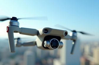
Key Features and Capabilities
Modern search and rescue (SAR) drones boast a range of advanced features and capabilities that make them highly effective in various rescue scenarios.
You can expect these drones to possess cutting-edge technology that enhances their performance and efficiency. One of the key features of SAR drones is their ability to operate autonomously, allowing them to navigate through challenging environments with minimal human intervention.
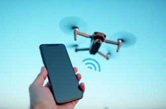
SAR drones are also equipped with integrated sensors that enable them to gather and transmit critical data in real-time.
These sensors can include:
- High-resolution cameras for visual inspection and mapping
- Thermal imaging cameras for detecting heat signatures
- LIDAR sensors for creating detailed 3D maps of the environment
The integration of these sensors and autonomous capabilities enables SAR drones to quickly and accurately locate missing persons, assess damage, and identify potential hazards.
This information is invaluable for emergency responders, allowing them to develop effective response strategies and allocate resources efficiently.
Enhancing Disaster Response
The advent of SAR drones has substantially enhanced disaster response efforts by providing emergency responders with critical information and situational awareness.
You can now assess damage and identify hazards in real-time, enabling more effective disaster prevention strategies. This capability allows you to allocate resources more efficiently, reducing the risk of further damage or loss of life.
SAR drones also facilitate emergency preparedness by providing detailed maps and 3D models of disaster areas.
You can use this data to develop targeted response plans, focusing on areas of highest need. Additionally, drones can detect potential hazards such as landslides or gas leaks, enabling you to take proactive measures to mitigate their impact.
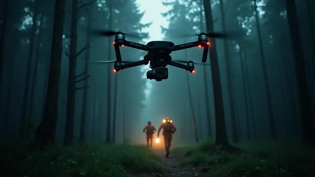
Locating Missing People
Drones are equipped with GPS tracking systems, enabling them to navigate complex search patterns.
This capability allows drones to methodically survey disaster-stricken areas, increasing the likelihood of locating missing people.
Key features of drone-assisted search operations include:
- *Real-time video transmission*, providing responders with live footage of the affected area
- *Infrared imaging*, enabling drones to detect heat signatures and identify potential survivors
- *Autonomous flight modes*, allowing drones to execute pre-programmed search patterns and adapt to changing environmental conditions
Delivering Critical Aid
When searching for missing people, you often need to deliver critical aid quickly and efficiently.
Aerial medical supply drops, enabled by search and rescue drones, can rapidly deliver life-saving supplies to remote or hard-to-reach areas.
Aerial Medical Supply Drops
How can search and rescue teams quickly deliver life-saving medical supplies to remote or disaster-stricken areas?
Aerial medical supply drops, a vital component of aerial logistics, have revolutionized emergency response by enhancing medical accessibility in challenging environments.
This innovative approach enables search and rescue teams to rapidly transport critical medical supplies, such as blood, vaccines, and antibiotics, to areas inaccessible by traditional means.
Aerial medical supply drops offer several benefits, including:
- Increased speed: Drones can quickly transport medical supplies over long distances, reducing delivery times and enabling timely treatment.
- Improved accessibility: Drones can navigate through challenging terrain, such as forests, mountains, or disaster zones, to reach remote areas.
- Enhanced cost-effectiveness: Aerial medical supply drops can reduce the costs associated with traditional transportation methods, such as helicopters or ground vehicles.
Rapid Response Capabilities
Effective search and rescue operations rely heavily on rapid response capabilities, where every minute counts in delivering critical aid to those in need.
As you deploy drones in emergency situations, a swift reaction is vital in saving lives. This requires a high level of emergency readiness, where drones are equipped with the necessary payloads, such as medical supplies, communication devices, and sensors.
When you receive a distress signal, every second counts.
A well-planned rapid response strategy enables you to quickly assess the situation, identify the location of those in need, and dispatch drones to provide critical aid.
This involves selecting the most suitable drone configuration, traversing through the most efficient route, and ensuring seamless communication with the rescue team.
Precision Aid Delivery
Delivering critical aid in search and rescue operations often requires precision to minimize risks and maximize the effectiveness of the response.
As a first responder, you understand the importance of prioritizing aid delivery to those who need it most. This is where search and rescue drones equipped with precision aid delivery capabilities come into play.
When it comes to aid prioritization, drones can be programmed to assess the situation and allocate aid based on the severity of the situation.
This enables you to optimize the delivery of critical supplies, such as food, water, and medical equipment, to those who require it most urgently.
- Drones can be equipped with sensors to assess the environment and identify areas of greatest need.
- Advanced algorithms can be used to prioritize aid delivery based on factors such as injury severity and location.
- Real-time data from the drones can be used to adjust the delivery strategy and guarantee that aid is delivered efficiently and effectively.
Real-Time Imagery Benefits
When utilizing search and rescue drones, you can acquire enhanced visual coverage of disaster areas through real-time imagery.
This capability enables you to rapidly assess damage and prioritize your response efforts effectively. By leveraging real-time imagery, you can also boost situational awareness, making it easier to coordinate rescue operations and allocate resources efficiently.
Enhanced Visual Coverage
Enhanced visual coverage through real-time imagery is a critical component of search and rescue operations, with drones playing a pivotal role in this area.
By leveraging drones, you can obtain enhanced visuals of the affected area, allowing for more informed decision-making.
The ability to capture real-time imagery from various angles and altitudes provides an exhaustive understanding of the situation.
When utilizing drones for search and rescue operations, you can benefit from the following advantages of enhanced visual coverage:
- Wide angles: Drones can capture broad areas, providing a larger field of view and enabling you to quickly assess the situation.
- High-resolution imaging: Drones can capture high-quality images, allowing you to discern even the smallest details.
- Oblique and nadir views: Drones can capture images from various angles, providing a more complete understanding of the affected area.
Rapid Damage Assessment
Rapid damage assessment is crucial in search and rescue operations, enabling you to quickly understand the extent of destruction and make informed decisions.
By utilizing drones equipped with high-resolution cameras and sensors, you can conduct a storm survey to assess damage in a fraction of the time it would take with traditional methods. This real-time imagery benefits your response efforts by providing actionable data to prioritize search and rescue missions.
Drones can be equipped with specialized sensors to measure damage, such as thermal imaging or LiDAR, allowing for precise damage metering.
This data can be used to identify areas of high priority, such as buildings with structural damage or areas with potential hazards. By analyzing this data, you can allocate resources more effectively, reducing the risk of injury to responders and improving overall response times.
The use of drones in rapid damage assessment also enables you to track changes in the environment over time, allowing for more accurate monitoring of the situation and more informed decision-making.
This capability is particularly valuable in dynamic environments, such as those affected by natural disasters.
Situational Awareness Boost
Real-time imagery from drones offers your response team a significant situational awareness boost, equipping you to make more informed decisions in search and rescue operations.
This visual intelligence provides a clear understanding of the situation on the ground, enabling you to allocate resources more effectively and prioritize tasks.
The real-time data collected by drones can be transmitted to your response team's command center or mobile devices, allowing for quick analysis and decision-making.
This capability is particularly important in dynamic environments where the situation can change rapidly.
Some key benefits of real-time imagery from drones include:
- Enhanced situational awareness: Real-time imagery provides a clear understanding of the situation, enabling you to make more informed decisions.
- Rapid decision-making: Real-time data allows for quick analysis and decision-making, ensuring that your response team can respond effectively to changing situations.
- Improved resource allocation: With accurate and up-to-date information, you can allocate resources more effectively, prioritizing tasks and minimizing waste.
When traversing hard-to-reach areas, search and rescue teams often rely on drones to access locations that would be difficult or impossible for humans to reach.
Rugged terrain and difficult landscapes, such as steep cliffs or dense forests, can hinder rescue efforts, but drones can navigate these areas with ease. Equipped with advanced sensors and GPS, drones can fly over or through challenging environments, gathering critical information and pinpointing the location of missing persons or disaster zones.
In mountainous regions, drones can quickly scan steep slopes and valleys, detecting signs of human presence or potential hazards.
In dense forests, drones can fly beneath the canopy, using specialized sensors to detect heat signatures or movement. This capability enables search and rescue teams to focus their efforts on the most likely areas, increasing the chances of a successful rescue.
Improving Response Times
When utilizing search and rescue drones, you can substantially improve response times by speeding up deployment and prioritizing high-risk areas.
Speeding Up Deployment
By streamlining pre-deployment procedures, you can substantially reduce the time it takes to get search and rescue drones airborne.
Fast deployment is critical in emergency situations where every minute counts. To achieve quick mobilization, simplifying and automating tasks is vital, minimizing the time spent on preparation and setup.
Key considerations for speeding up deployment include:
- Automated systems: Implementing automated systems for tasks such as drone configuration, battery charging, and payload attachment can greatly cut down on manual labor and errors.
- Pre-configured settings: Pre-configuring drone settings for common search and rescue scenarios can save time during deployment, allowing you to focus on the mission at hand.
- Standardized equipment: Standardizing equipment and accessories can simplify the deployment process, reducing the time spent on setup and troubleshooting.
Prioritizing High-Risk Areas
Once a search and rescue drone is airborne, response times can substantially impact the effectiveness of the mission.
To improve response times, you must prioritize high-risk areas using advanced risk profiling techniques. This involves analyzing environmental and situational factors to identify areas where search and rescue efforts are most critical.
By leveraging risk profiling, you can optimize resource allocation and guarantee that drones are deployed to areas with the highest probability of locating missing persons or surveying damage.
This approach enables you to allocate resources more efficiently, reducing the time it takes to respond to emergencies.
Effective risk profiling requires access to real-time data and advanced analytics.
You can utilize sensors, satellite imagery, and other data sources to gather information on environmental conditions, terrain, and other factors that may impact search and rescue operations.
Reducing Responder Risks
Deploying search and rescue drones can substantially reduce the risks responders face during emergency operations.
By leveraging drone technology, you can markedly enhance responder safety while maintaining effective emergency response efforts.
Drones can access hazardous or hard-to-reach areas, reducing the need for responders to put themselves in harm's way.
This approach enables you to gather critical information and conduct reconnaissance without exposing responders to potential dangers.
The benefits of drone deployment for risk mitigation include:
- Reduced exposure to hazardous environments, such as chemical spills or burning buildings
- Minimized risk of injury or death from falling debris or structural collapse
- Enhanced situational awareness through real-time aerial footage and sensor data
Future of SAR Drone Technology
Several factors will drive the future of SAR drone technology. As you consider implementing drones in your search and rescue operations, verifying the evolving landscape is crucial.
Advances in autonomous systems will play a significant role in shaping the future of SAR drones. Autonomous systems enable drones to operate independently, making decisions in real-time without human intervention.
This capability will enhance the effectiveness of SAR operations, allowing drones to quickly scan large areas and identify potential targets.
Drone regulations will also influence the future of SAR drone technology. Governments are establishing guidelines for drone operations, including requirements for registration, pilot training, and airspace management.
You'll need to stay up-to-date on these regulations to guarantee compliance and maximize the benefits of drone technology. Additionally, the integration of emerging technologies, such as artificial intelligence and computer vision, will further enhance the capabilities of SAR drones.
Frequently Asked Questions
Can SAR Drones Operate in Extreme Weather Conditions?
When operating in extreme conditions, you'll find that SAR drones can withstand ice storms and high wind resistance, but their performance may degrade, requiring you to adjust flight paths and parameters to maintain stability.
How Are SAR Drones Regulated and Licensed?
You'll need to comply with regulations, like the FAA's Part 107, requiring Pilot Certification and Airspace Authorization for drone operations. For example, the city of Raleigh's drone program verifies licensed pilots only fly in approved airspace.
What Is the Average Cost of a SAR Drone System?
When considering drone financing, you'll find the average cost of a SAR drone system varies. System pricing typically ranges from $10,000 to over $100,000, depending on sensor suites, drone size, and software capabilities.
Can SAR Drones Be Integrated With Existing Emergency Systems?
You can integrate SAR drones with existing emergency systems by ensuring system compatibility and fostering infrastructure synergy, enabling seamless data exchange between drone operations and legacy emergency response systems for enhanced situational awareness.
What Are the Data Storage and Security Protocols for SAR Drones?
You carefully configure your drone's data storage and security protocols, opting for Cloud Storage solutions and implementing robust Data Encryption methods to safeguard sensitive information and guarantee secure data transmission and storage processes.
Conclusion
You've witnessed the transformative impact of search and rescue drones on emergency response. With their advanced capabilities and real-time data transmission, SAR drones have saved countless lives and reduced disaster response times. Particularly, according to a recent study, the use of SAR drones can decrease response times by up to 50% in disaster scenarios. As this technology continues to evolve, its potential to revolutionize emergency response will only continue to grow.